Hudson – 2016
The CaD studio in the Spring of 2016 focused on the South Bay waterfront area of Hudson, New York. With a regionally and nationally important past as a strategic port for the whaling industry, in more contemporary times Hudson has undergone significant growth and property valuation driven in part by the efficient transportation network connecting the City of Hudson to New York City. Many have discovered the benefits of either living in Hudson and working in Manhattan during the week, owning a relatively inexpensive second home in Hudson for weekend use, or visiting Hudson for extended weekends as a visitor. The downtown area of the City of Hudson has undergone major revitalization and success as a growing commercial center supporting artists, antique dealers, and tourism. Many older and historically significant buildings have been renovated to support these interests, but space is limited. This interest in Hudson, and present and future needs to accommodate a growing and diverse tourism and maker economy, has resulted in renewed attention in the cities historic waterfront.
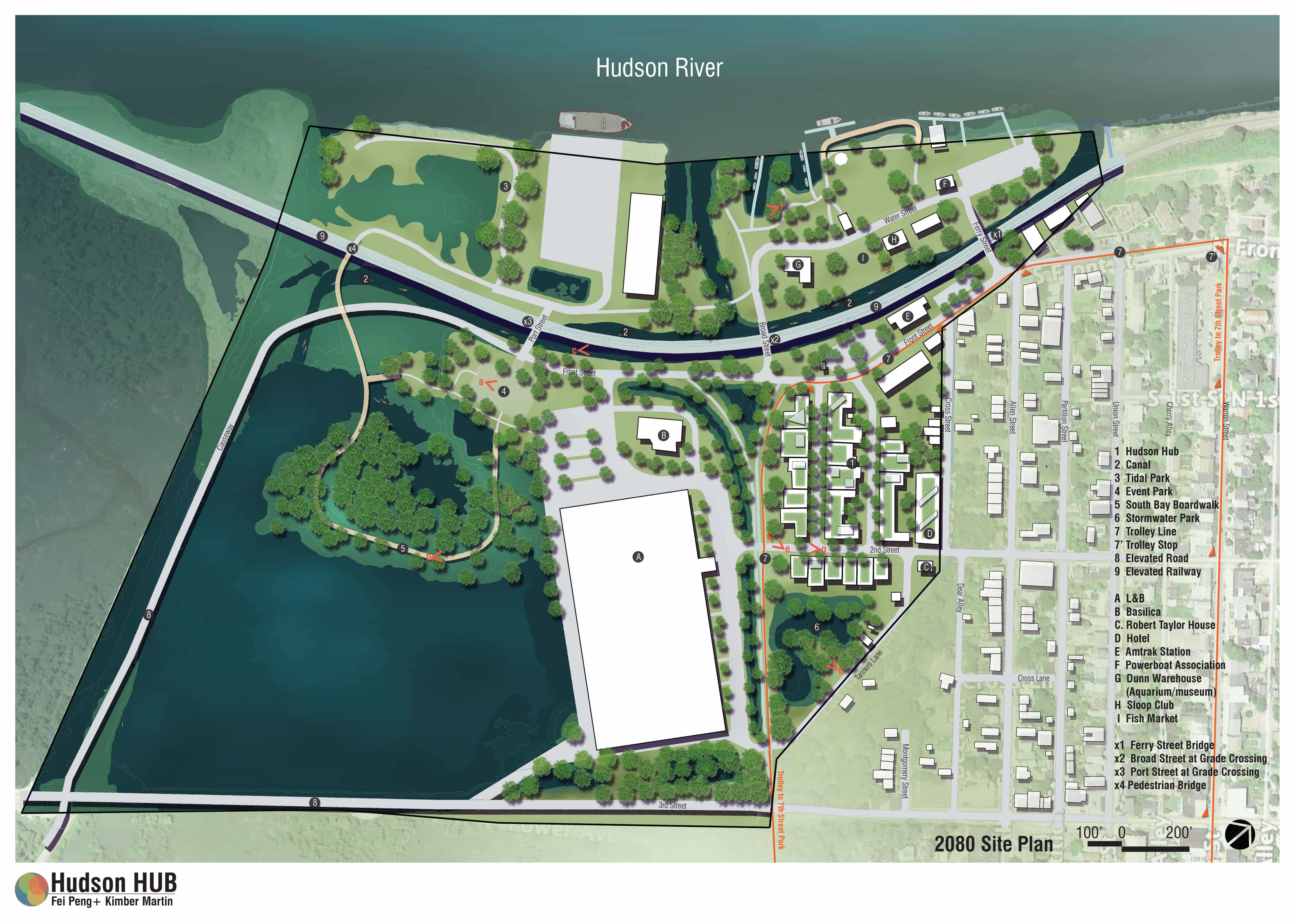
Hudson Hub
Unsinkable: The Wetland Industrial Complex
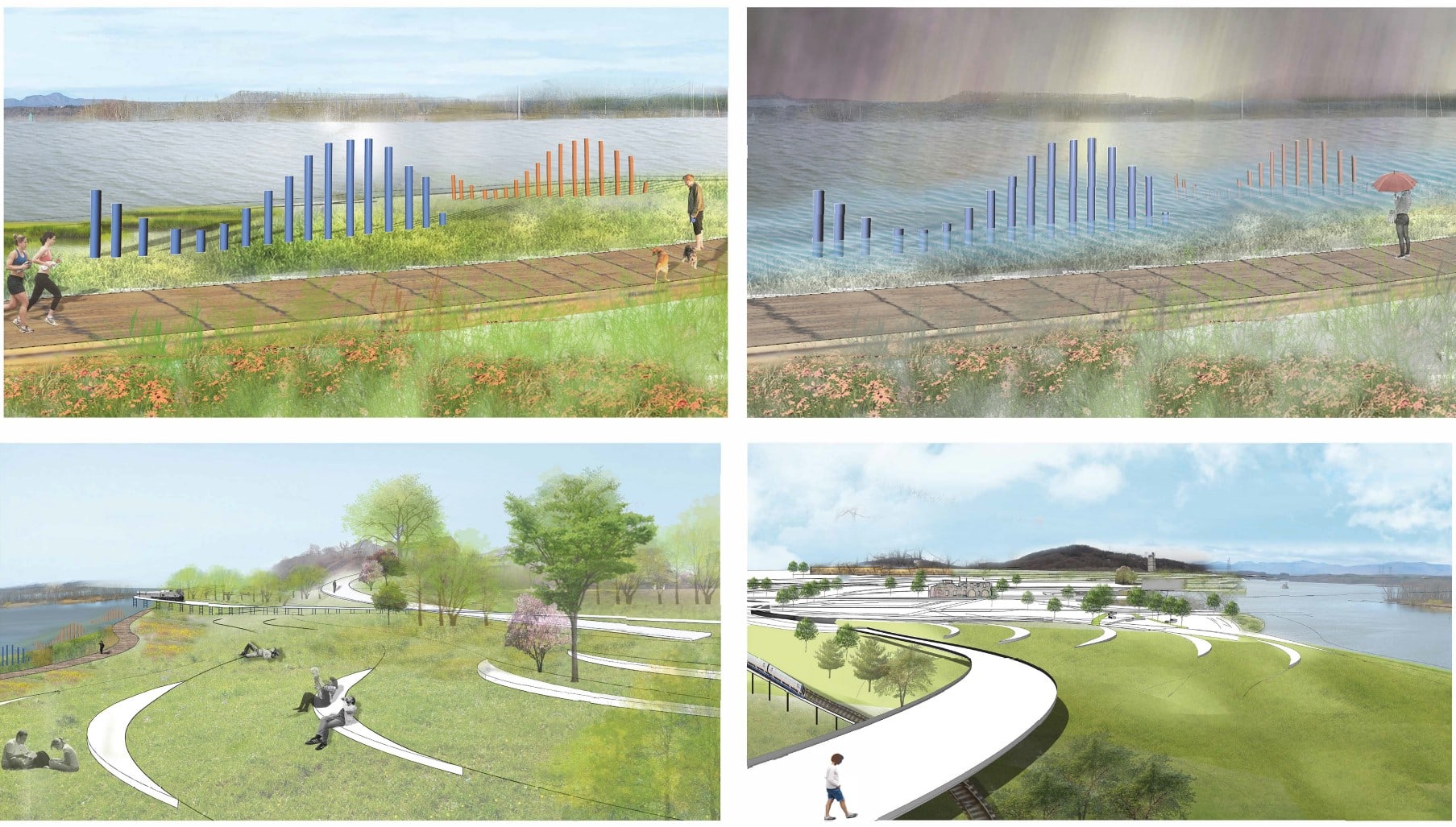
Time Refractor
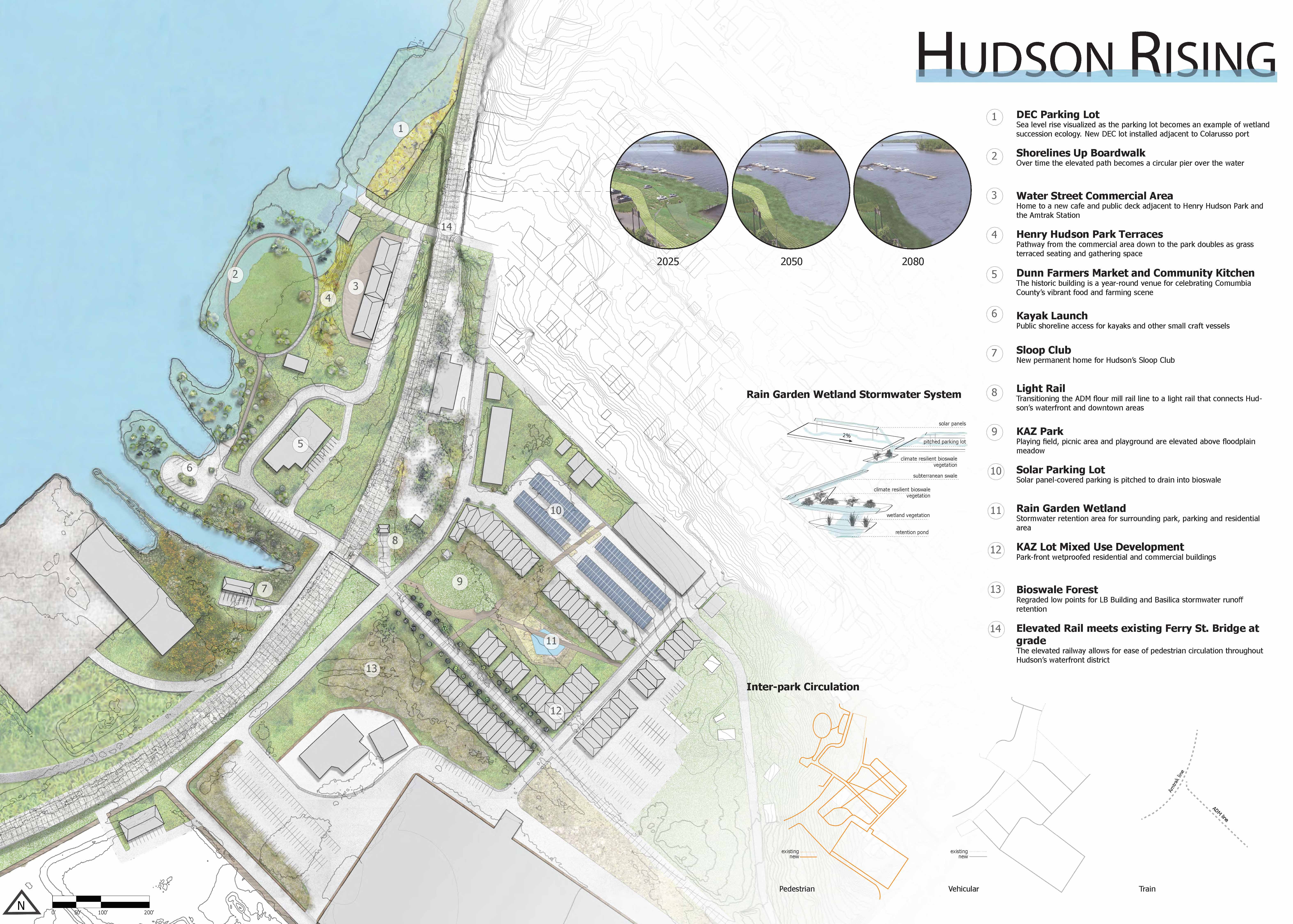
Hudson Rising
Hydrotropic Hudson
Higher Hudson
Bridge the Gap
This project is funded by NYS Water Resources Institute at Cornell University and the NYSDEC Hudson River Estuary Program with support from the NYS Environmental Protection Fund.